


Canal Voting District, Okanogan County, Washington
About
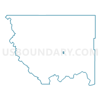
Outline

Summary
| Unique Area Identifier | 687690 |
| Name | Canal Voting District |
| County | Okanogan County |
| State | Washington |
| Area (square miles) | 1.93 |
| Land Area (square miles) | 1.93 |
| Water Area (square miles) | 0.00 |
| % of Land Area | 100.00 |
| % of Water Area | 0.00 |
| Latitude of the Internal Point | 48.43928510 |
| Longtitude of the Internal Point | -119.55967930 |
Maps


Graphs
Select a template below for downloading or customizing gragh for Canal Voting District, Okanogan County, Washington


Neighbors
Neighoring Voting District (by Name) Neighboring Voting District on the Map
- Dixon Voting District, Okanogan County, WA
- Duck Lake Voting District, Okanogan County, WA
- Fiker Voting District, Okanogan County, WA
- Pogue Voting District, Okanogan County, WA
- Ross Canyon Voting District, Okanogan County, WA